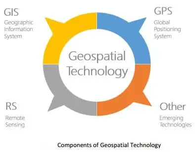
In today’s digital age, geospatial data has become an invaluable resource across various sectors, including urban planning, environmental monitoring, marketing, and national security. However, as the collection and use of geospatial information grow, it is crucial to consider the ethical implications of geospatial technology data collection and use to ensure responsible practices and protect individual rights.
What is Geospatial Data?
Geospatial data refers to information that identifies the geographic location of features and boundaries on Earth. This data can come from satellites, GPS devices, mobile phones, drones, and other technologies. The ability to map and analyze spatial data has transformed how decisions are made, providing insights that were previously unavailable.
Privacy Concerns in Geospatial Data Collection
One of the most significant ethical challenges in the ethical implications of geospatial data collection and use is privacy. Collecting precise location data can inadvertently expose sensitive personal information, leading to unauthorized tracking and surveillance. For instance, when geospatial data is linked to individuals’ movements or behaviors, it can reveal patterns that might be exploited for commercial gain or even malicious purposes.
Informed Consent and Transparency
Ethical data collection requires that individuals provide informed consent before their location information is gathered. Transparency about how data will be used, stored, and shared is essential to building trust. Unfortunately, many users are unaware that their geospatial data is being collected, or how it might be utilized, raising ethical red flags.
Bias and Discrimination Risks
Another concern in the ethical implications of geospatial data collection and use involves the risk of bias and discrimination. Geospatial data, if not carefully managed, can reinforce social inequalities. For example, mapping data might disproportionately focus on certain neighborhoods, leading to uneven resource allocation or surveillance that targets marginalized communities unfairly.
Security and Data Protection
Protecting geospatial data from unauthorized access and breaches is a critical ethical responsibility. Given that location data can be highly sensitive, organizations must implement robust security measures to prevent hacking or misuse. Failure to secure this information can have serious consequences, including threats to personal safety.
Ethical Guidelines for Responsible Use
To address the ethical implications of geospatial data collection and use, several guidelines have emerged. These include principles of privacy protection, transparency, fairness, and accountability. Organizations collecting and using geospatial data must:
- Obtain explicit consent from individuals.
- Use data only for stated, ethical purposes.
- Ensure equitable treatment of all communities.
- Protect data through strong cybersecurity protocols.
- Regularly review and update ethical standards as technology evolves.
Conclusion
The power of geospatial data brings tremendous benefits, but it also comes with significant responsibilities. Understanding and addressing the ethical implications of geospatial data collection and use is essential to ensure that this technology serves society positively without compromising individual rights. By fostering transparency, consent, and fairness, stakeholders can harness the potential of geospatial information while upholding ethical standards.


